New York, one of the cities of the world with the most organized cities. Streets are either numbers, letters and, occasionally, other names...kinda like a perfect map. But, sometimes, so many numbers and letters can be pretty confusing. I don’t know about you, but I sometimes come out of the subway and feel completely lost. İ don’t know if I should go up the Street, down or turn to a different Street.
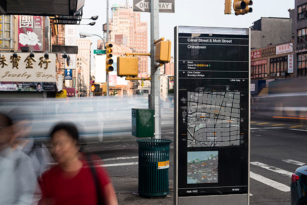
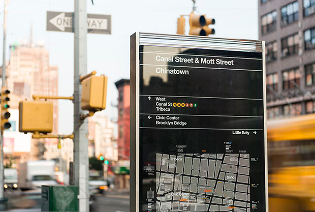
That, and because NYC has so much to see and do, if you are or will be in the big apple in the next months you will be lucky enough to see the new mapping system there have started to implement. The new map project, designed by Pentagram, are called WalkNYC and they use the wayfinding system. Wayfinding, for those of us who don’t know what it is (myself included), is the easy signs, the easy way of finding your way or to position yourself in a map.
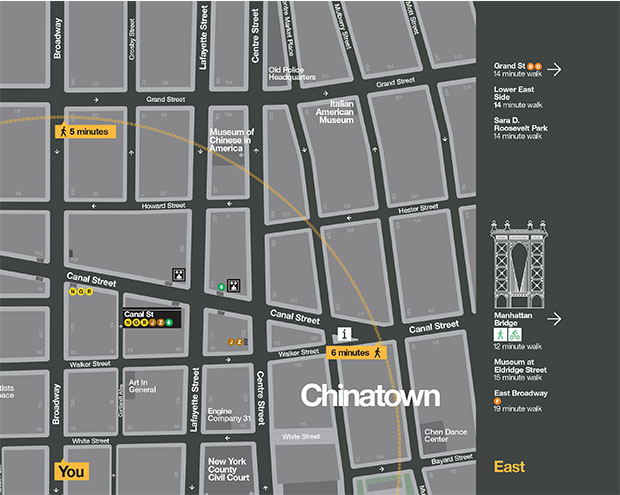
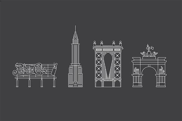
The map makes a city so full of things and complex as is NYC into something simple to read and understand thru a simple gamma of colors, symbols and signs. The map shows museums, emblematic buildings, hospital, subway stations and even the bicycle lanes of the city.
It’s pretty, simple and super practical! Cities of the world, watch out!
Nueva York, una ciudad con calles perfectamente ordenadas. Las calles que suben son números y avenidas, la calles horizontales son letras…como un mapa perfecto. Pero, a veces, tanto numero y tanta letra marea. Muchas veces, salimos del metro y no sabemos si tenemos que subir la calle, bajarla o girar.
Por eso, y porque NY tiene tanto que ver y tanto que hacer, los que estéis o vayáis a ir en los próximos meses tendréis la suerte de ver los nuevos mapas de diseño que están empezando a poner por toda la ciudad. El nuevo proyecto de mapas, diseñados por Pentagram, se llaman WalkNYC y usan el sistema de wayfinding. El wayfinding, para los que no sabemos lo que es (yo me incluyo, porque es la primera vez que lo oigo), es la señalización fácil, forma de encontrar nuestro camino o la manera de orientar el norte.
El mapa consigue convertir algo tan lleno de cosas y complejo como la ciudad de Nueva York en algo simple de leer y entender a través de símbolos y señales cómodas e internacionales. El mapa muestra los museos, edificios emblemáticos, lugares turísticos, hospitales, metros y hasta los carriles bici.
¡Es bonito, simple y súper practico! ¡Ciudades del mundo, tomad nota!

Source: Graffica
No hay comentarios:
Publicar un comentario